Stay weather aware with Weather Report
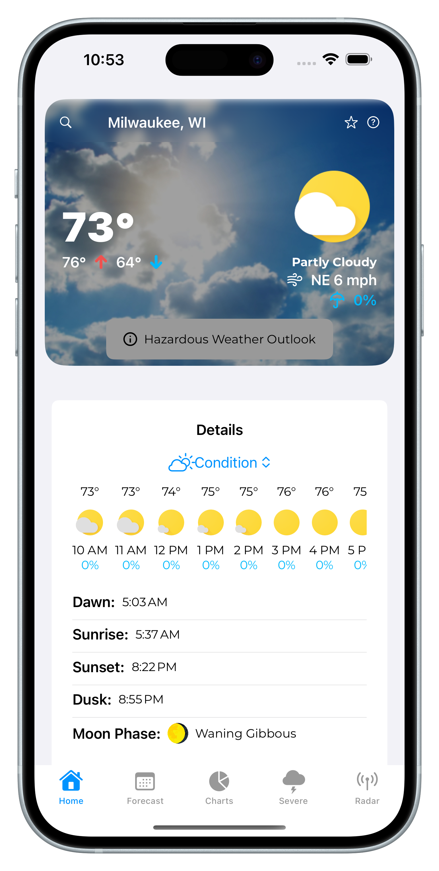
Local Forecasts made by meteorologists at the National Weather
Service
Receive Notifications for local Alerts
See Severe Weather Outlook Graphics
Made and actively supported by a High-School Student


View
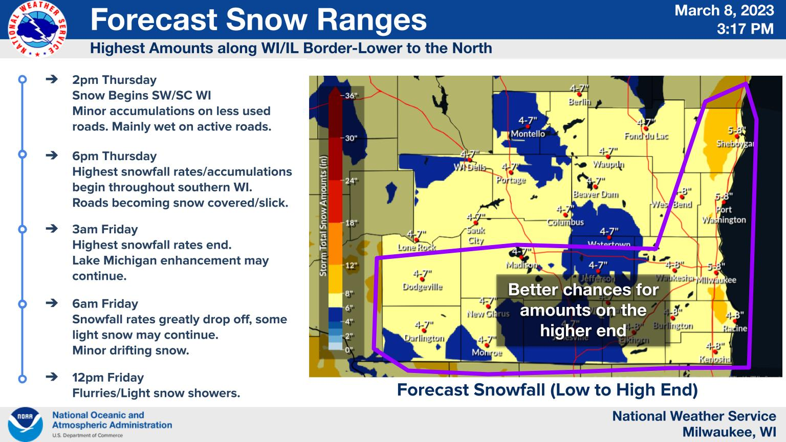
NOAA graphics
and
outlooks
Storm Prediction Center
Convective Outlooks and Mesoscale Discussions keep you informed about severe weather, before it strikes.
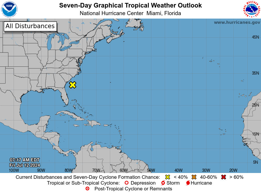
National Hurricane Center
Weather Prediction Center
Local National Weather Service
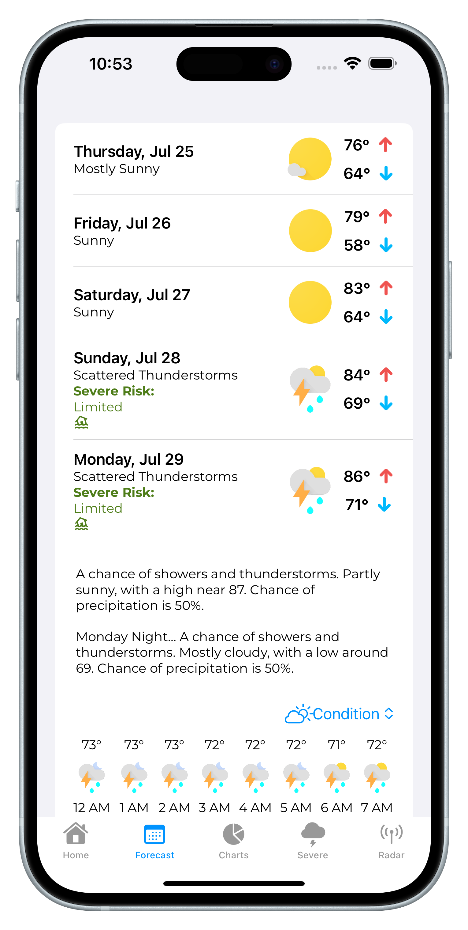
Hourly Forecasts.
Adjusted by real people.
Most apps just use direct weather model output with no human
reasoning. That works great 90% of the time, but why settle
for 90%. The National Weather Service forecasts are fine-tuned
to adjust for your area's unique weather.
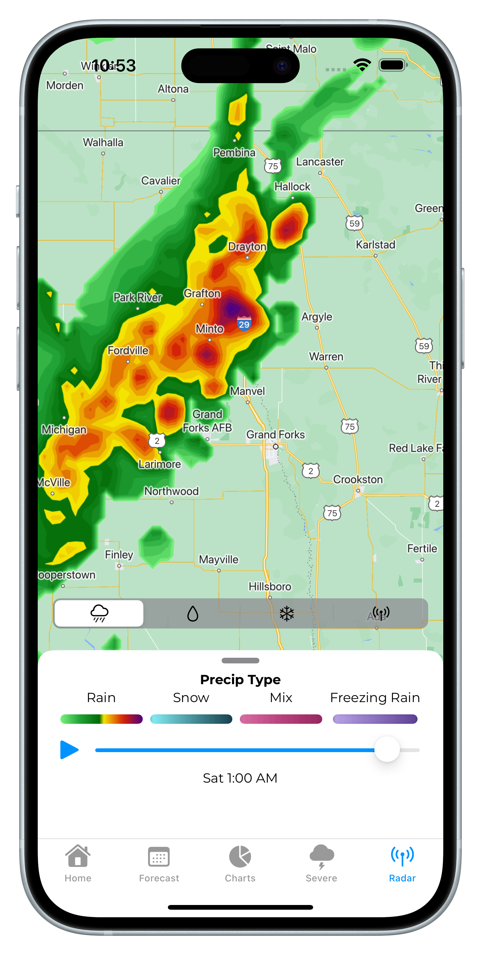
48-Hour Radar.
For free.
48-Hour radar is from the HRRR computer model. It is decently
accurate, but for real-time conditions, you can opt for
Precipitation Intensity based on Doppler Radar. View 48-Hour
predicted accumulations for free (also from HRRR).